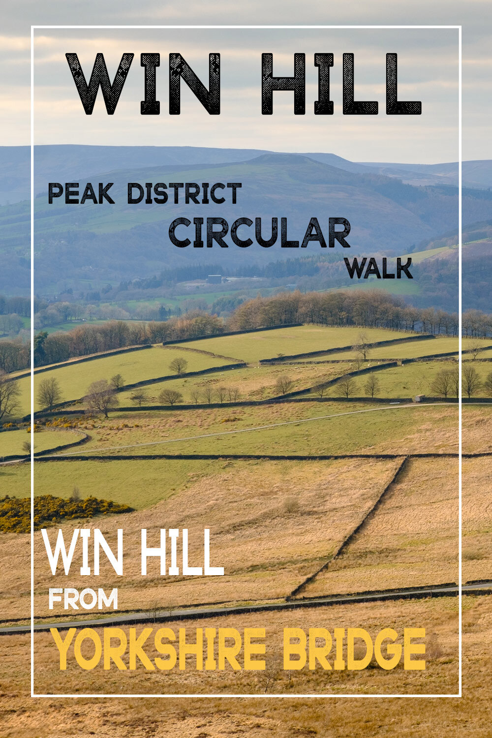
Win hill is situated near the beautiful peak district village of Bamford and offers some of the best 360-degree views in the area. The summit is officially 462 meters and has a trig point named winhill pike. The Win hill circular walk starts at Yorkshire bridge which has limited free roadside parking. If however, you visit on a busy day then parking can be found in the layby on the main road or further up at the Heatherdene car park adjacent to Ladybower reservoir on the A6013.
CIRCULAR ROUTE ELEVATION: APPROX 300 METERS
CIRCULAR ROUTE DISTANCE: APPROX 3 MILES
DIFFICULTY: MODERATE TO STRENUOUS OVER THE FIRST 1/2 MILE, GOING EASY THEREAFTER
ADDRESS: LYDGATE LANE, YORKSHIRE BRIDGE, BAMFORD, DERBYSHIRE S33 0AZ

This Win hill circular walk starts at Yorkshire bridge. As you cross the bridge, look to your right and you will see the beautiful cascades which I photographed at the end of the vlog, if you decide you would like to check it out or photograph it yourself, you can gain waterside access by entering to the right before you cross the bridge. Follow the small mud track down to the water’s edge. Be mindful here though as the mud path is extremely slippery, as are the mossy boulders at the water’s edge. This shot of the waterfall/cascades works best on a cloudy day or late evening when the sun has set behind the tree line. Autumn or early spring would probably be the best time to visit for fantastic woodland colours.
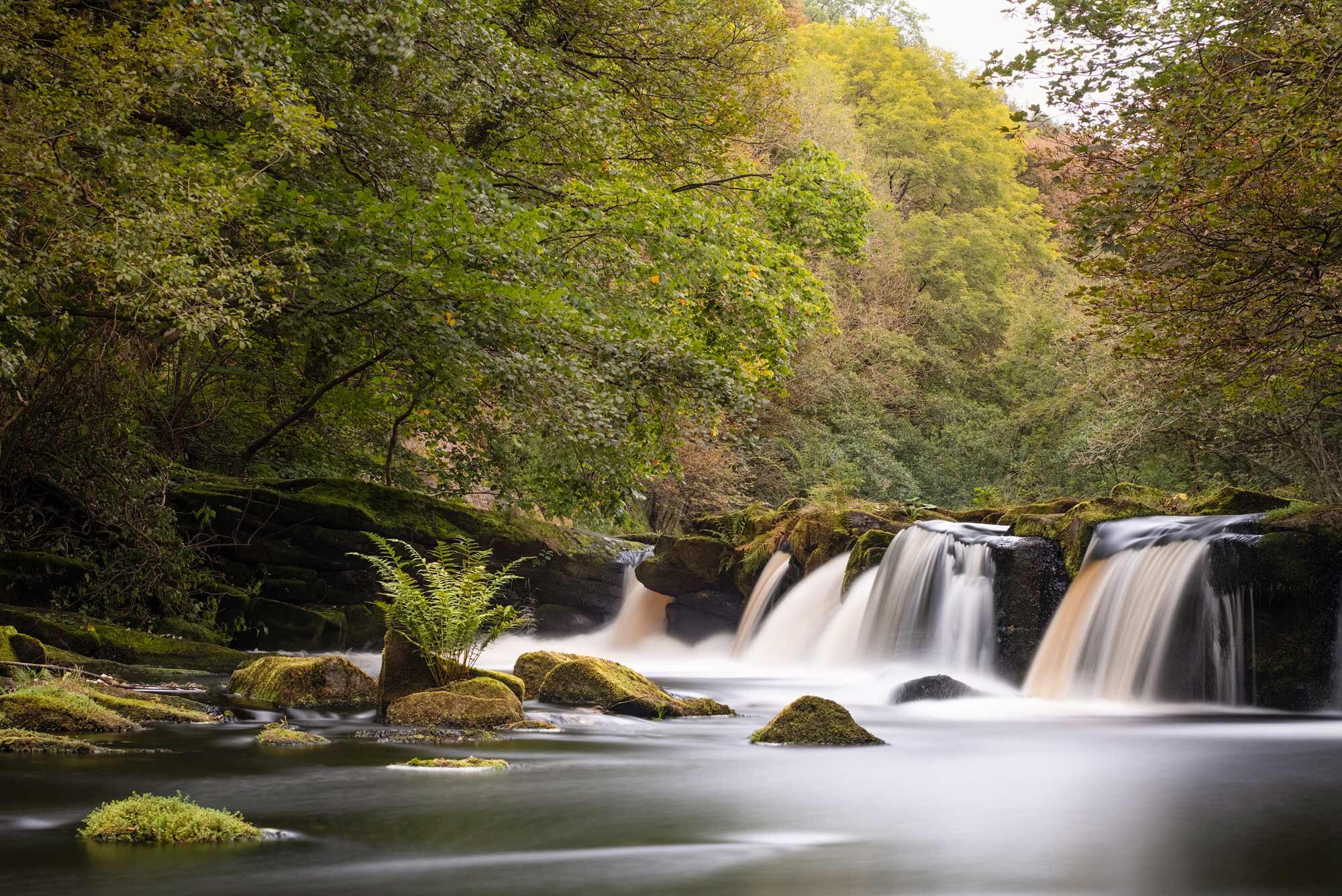
Right waterfall photo done !! let’s crack on with the walk itself.
Cross the bridge and take the road around to your right, shortly you will come to a gate which is directly opposite the waterfall. Here you will see the handrails on your left which mark the start of the ascent to the summit. (Marked 1 on the map). The first half a mile or so will see you gain almost 70% of the total height of this walk, so be prepared for a blood-pumping first 20 minutes or so. The walk follows the route up parkin clough, a very tranquil area with a small running stream and ferns in abundance. During wet spells, several waterfalls form here, but these were not visible on my visit. After half a mile you will get your first respite before entering open moorland. The woodland changes to a more open area and the beautiful dry stone wall looks to provide a good photo opportunity during the right conditions. After a short rest keep straight on the path as you reach the crossroads and you will be greeted by some lovely heather and views across Ladybower, the Ashopton bridge and behind you back towards Bamford edge. Here you will see Winhill pike or the pimple as it is locally known. (Marked 2 on the map ). This rocky outcrop is the highest point of the walk so head straight up for 360-degree views of the hope valley, the great ridge, Castleton, Hathersage and the reservoirs. Across the snake road you will see crook hill, this also offers classic views of the area.
There are countless photo opportunities at the summit, I think it would be a great place to shoot the heather during mid-August when it is in full bloom. I think it is a place to visit at either sunrise or sunset, maybe a cheeky wild camp would be great too.
As you head past the trig point the path descends across the heather moor until you reach a path on your right, I would say it is around 200 meters from the summit. Take this right path and head down the hill heading back towards the reservoirs. You will eventually reach a drystone wall after a half a mile or so. This is where I took my first photo of the trip, looking back to Bamford edge. The more I look at this image the more I think that it is a sunrise location. Just imagine a beautiful red sunrise with the sun popping up over the rocks in the upper left hand third. Just bear in mind though, I visited in early September. It would be well advised to check the photographer’s ephemeris to get the correct position of the sun if you plan to capture this shot at a different time of the year.
This is photo spot 3 on the map

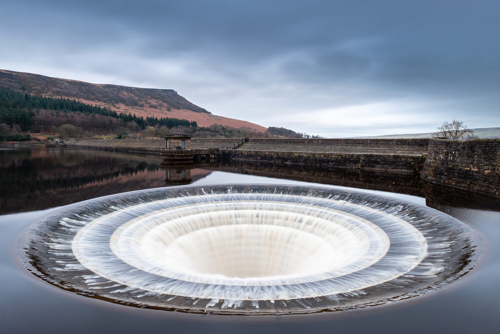
Next, you will head through the kissing gate and the plantation towards the water's edge ( marked 4 on the map). Turn right at the bottom when you reach the gravel road and follow the path as it navigates you back towards Ladybower dam. At the dam, you will see the plug holes that featured in one of my vlogs from earlier in the year, definitely worth photographing should they be flowing.
Follow the concrete path down the slope that follows the river Derwent back to your car at Yorkshire bridge.
If you are looking for a quick bite to eat and do not have time for the pub, I can highly recommend the Hathersage bakery. The hot breakfast cobs certainly hit the spot.
Hathersage bakery, Station Rd, Hathersage, Hope Valley S32 1DD
I hope you enjoy the walk.
Feel free to share this blog post on your social media if you think others might like it, also check out my youtube video for a look at the terrain and route. Feel free to print this info out and take it with you if you think it will be helpful on your journey. I would love to hear about your hike if you choose to take on this cracking circular route of Win Hill in the peak district.
Enjoy ATB Ian
view my walking and camera gear
Check out the video above for a good look at the walk and terrain,